1
/
of
1
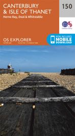
Canterbury Thanet OS Map
Canterbury Thanet OS Map
Regular price
£11.99 GBP
Regular price
Sale price
£11.99 GBP
Unit price
/
per
Tax included.
Shipping calculated at checkout.
Couldn't load pickup availability
Discover Canterbury, city of saints and kings, ancient heartland of England at the foot of the Kent Downs and the head of the River Stour Valley with its vineyards. Follow the river to the coast to discover unspoiled Deal, artistic Margate and picturesque Whitstable.
- Starting in Canterbury, take the Stour Valley Walk to Sandwich and the long sweeping sand and shingle beach of Sandwich Bay
- Walk the Long Rock from Whitstable to Herne Bay before taking the Thanet Coastal Path around the Isle of Thanet and its three famous Georgian and Victorian resorts of Margate, Ramsgate and Broadstairs
- Take the National Trails of the England Coast Path and North Downs Way or choose from a lattice of other popular recreational paths
OS Explorer Maps:
- 1:25 000 scale (4 cm to 1 km – 2½ inches to 1 mile).
- Great for walkers, hikers, cyclists, families, dog walkers, and horse riders.
- Includes roads, rights of way, permissive paths and bridleways, plus essential visitor information.
- Free digital download included.
- Other Ordnance Survey maps of Kent include Sittingbourne & Faversham Explorer map 149 and Dover, Folkestone & Hythe Explorer map 138
Share