1
/
of
1
Maidstone & the Medway Towns Map | Kent Downs | Ordnance Survey
Maidstone & the Medway Towns Map | Kent Downs | Ordnance Survey
Regular price
£11.99 GBP
Regular price
Sale price
£11.99 GBP
Unit price
/
per
Tax included.
Shipping calculated at checkout.
Couldn't load pickup availability
Walk a beautiful stretch of the North Downs Way offering spectacular views of the Kent Downs, Medway Valley and towards the Channel. Discover Kentish villages with their distinctive oast-house chimneys, vineyards on sunny slopes and romantic ruins as you head towards Rochester and its imposing castle guarding the road to London.
- Visit the Historic Dockyard Chatham, a beautifully-preserved relic of the Age of Sail home to three historic warships and much more
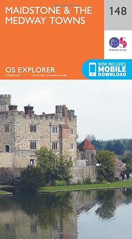
- Travel back in time at Leeds Castle near Maidstone, described as ‘the loveliest castle in the world’, or even further back at the megalithic dolmen known as Kit’s Coty
- Walk, hike or cycle along the North Downs Way and other recreational maps including the Medway Valley Walk and Wealdway
OS Explorer Maps:
- 1:25 000 scale (4 cm to 1 km – 2½ inches to 1 mile).
- Great for walkers, hikers, cyclists, families, dog walkers, and horse riders.
- Includes roads, rights of way, permissive paths and bridleways, plus essential visitor information.
- Free digital download included.
- Other Ordnance Survey Explorer maps of the North Downs Way include Gravesend & Rochester 163 and Ashford 137
Share